


- Japan is a country in East Asia comprising
a archipelago along Pacific coast of Asia.
- The country is southeast of the Russian Far East,
separated by the Sea of Okhotsk.
- It is slightly east of Korea, separated by the
Sea of Japan.
- It is also located east-northeast of China and
Taiwan, separated by East China Sea.
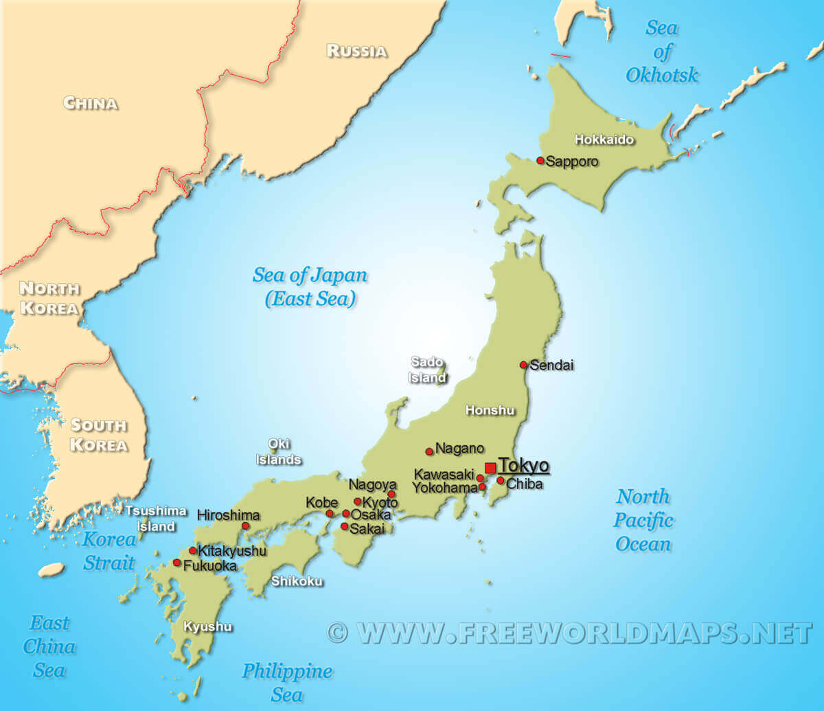 |
| Japan and its neighboring countries |
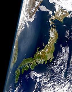 |
Satellite
view of Japan
|
- About 72% of Japan is mountainous, with a mountain range running through each of
the main islands. Japan's highest mountain is Mt.
Fuji.
- Since very little flat area,
many hills and mountainsides are cultivated all the way to the top.
 |
| Mount Fuji with a Shinkansen and Sakura blossoms in Shizuoka prefecture, in May |
- Japan situated in a volcanic
zone along the Pacific deeps, frequent low-intensity earth tremors
and occasional volcanic activity are felt throughout the islands.
- Destructive earthquakes occur
several times a century.
 |
Strong
current in 2011 Earthquake and
Tsunami, hits Miyako
|
- Nearly 80% of Japanese land is
mountainous, with numerous small and narrow plains found mainly along the
coasts.
- Basins are found inland, and
where mountains and plains or basins meet, river fans have
developed.
- The coastline is complex and
heavily indented, with numerous bays and peninsulas.
 |
Major
city in Hokkaido, located on flat land
|
 |
| Seascapes and ice-scapes in Zao National Park |
 |
Beautiful
Shirahama Beach
located at Izu Peninsula, West Tokyo
|


No comments:
Post a Comment